
Free Chrome extension
See every railway line on Google Maps
Google Maps hides most of the rail network. Railway Highlighter draws rail, subway, tram and light rail lines right on the map, from OpenStreetMap data, in any country.
 Add to Chrome — it's free
- No account
- Works worldwide
- Map and satellite views
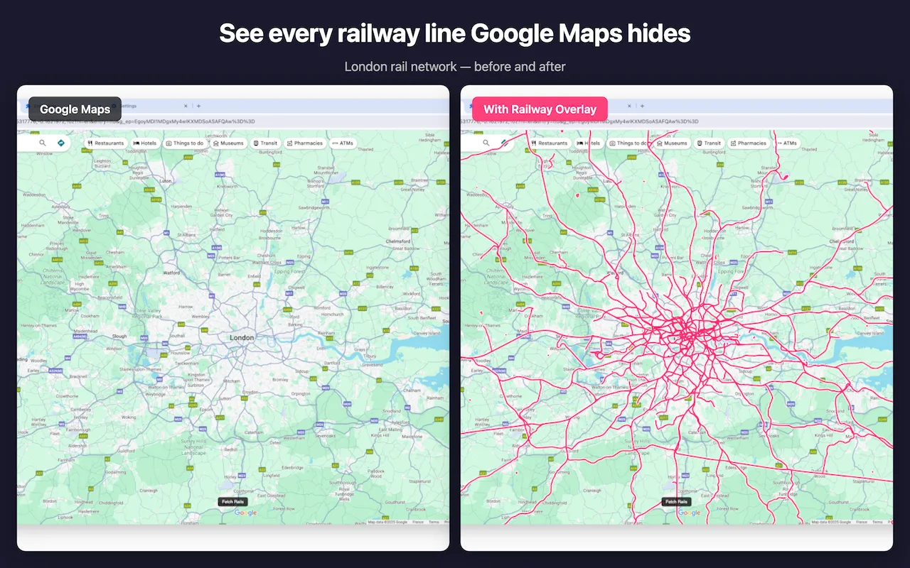
Railways, metros and trams, one click away
Pick the lines you care about; each type has its own colour.
Six rail types
Rail, light rail, subway, tram, narrow gauge and monorail, each in its own colour.
Drawn on the map
Lines sit on top of Google Maps and follow it as you pan and zoom, in map and satellite views.
Any country
Uses OpenStreetMap, the world's open map, maintained by volunteers everywhere.
Reliable loading
If a data server is busy, it switches to another one by itself and tells you what is happening.
Your layout
Drag the card where you want it; your rail types and position are remembered.
Private
No account, and it never records the places you look at.
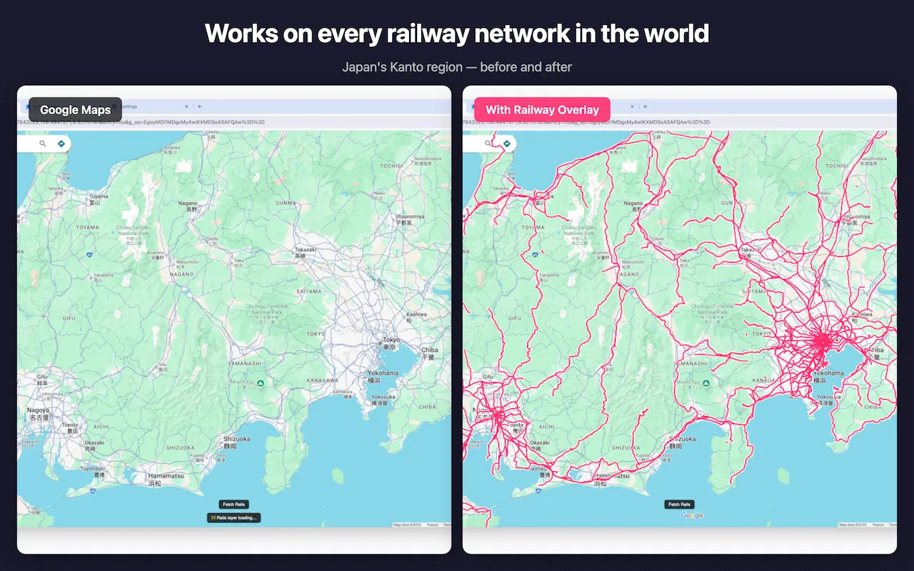
Line colours
- Rail Main lines and intercity routes
- Light rail Light rail and suburban lines
- Subway Metro and underground networks
- Tram Tram and streetcar routes
- Narrow gauge Mountain and heritage railways
- Monorail Monorail systems
How it works
- Add Railway Highlighter to Chrome, then open Google Maps.
- Find the Railway Highlighter card on the right of the map and tick the rail types you want.
- Click "Fetch Rails". The lines in the area on screen appear on the map. After moving to another area, click again.
Your privacy
Railway Highlighter only needs to know which part of the map to draw.
No account
Nothing to sign up for. Your settings stay in your browser.
Map area only
To get railway data, the extension sends the area on screen to OpenStreetMap servers, and nothing else.
Anonymous statistics
Counts such as whether loading worked, never your locations. You can turn them off.
Questions and troubleshooting
How do I use it?
Open Google Maps, find the Railway Highlighter card on the right of the map, tick the rail types you want and click "Fetch Rails". The lines in the visible area are drawn on the map and follow it when you pan or zoom. After moving somewhere else, click "Fetch Rails" again.
It says the servers are busy. Is it broken?
No. Railway data comes from free, volunteer-run OpenStreetMap servers (Overpass API), which are sometimes overloaded. The extension tries several servers by itself and shows what it is doing under the button. If all of them are busy, wait a minute or two and click again.
Nothing appears when I click "Fetch Rails".
Zoom in to level 7 or closer (about the size of a region): larger areas are refused. If the message says the area is too dense, zoom in a little or untick some rail types. In satellite view it works too; Street View and tilted 3D views are not supported.
The card has disappeared from the map.
Clicking the extension icon in the browser toolbar hides or shows the card. Click it again to bring the card back. If you can't see the icon, click the puzzle piece in the toolbar and pin Railway Highlighter.
Which browsers does it work in?
Google Chrome and other Chromium browsers that install from the Chrome Web Store, such as Microsoft Edge, Brave and Opera.
Is it free? What data does it collect?
It is free, with no account. Railway data is requested from OpenStreetMap servers for the area on screen. The extension sends anonymous usage statistics (such as whether loading worked and how long it took) that never include the places you look at, and you can turn them off on its welcome page.
Still stuck? Write to [email protected] and say what the card shows.